landkarten und stiche - Stamp Auctions

Lot 25378 - landkarten und stiche  -  Auktionshaus Christoph Gärtner GmbH & Co. KG Sale #44 Germany, Picture Post cards

Lot 25378 - landkarten und stiche - Auktionshaus Christoph Gärtner GmbH & Co. KG Sale #44 Germany, Picture Post cards

Landkarten und Stiche: 1750. (ca.) Episcopatus Numburgensis et Cizensis delineatio geographica, adje
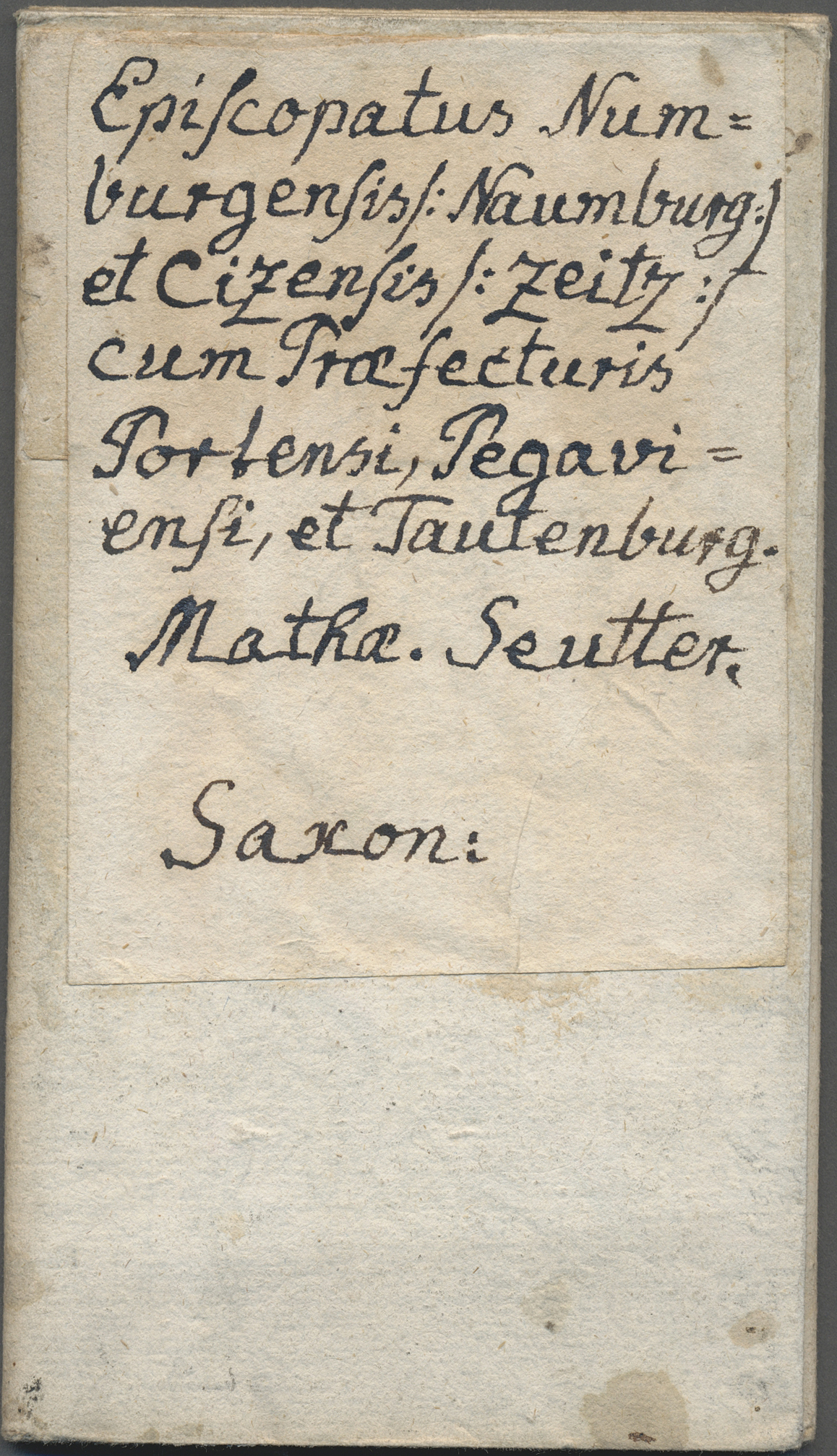
1750. (ca.) Episcopatus Numburgensis et Cizensis delineatio geographica, adjectis praefecturis Portensi, Pegaviensi, Tautenburg[ensi] et finitimis. Matthäus Seutter. Large Naumburg Saxony map with ornate cartouche, map key, and great bird's-eye view of the city by Matthäus Seutter in 1750; on heavy laid paper with blank verso to which has been affixed a period label in Latin. Trimmed to neat line or slightly in and folded for travel use which has kept the period hand coloring and excellent impression remarkably fresh. Would look beautiful matted and framed. Worn through at a few of the fold vertices. Original antique copperplate map circa 250 years old.
For this lot an additional 7% for Import Expenses (Taxes) will be charged.
View our Terms & Conditions

Auktionshaus Christoph Gärtner GmbH & Co. KG Sale #44 Germany, Picture Post cards

landkarten und stiche
Lot 25405 - landkarten und stiche  -  Auktionshaus Christoph Gärtner GmbH & Co. KG Sale #44 Germany, Picture Post cards

Lot 25405 - landkarten und stiche - Auktionshaus Christoph Gärtner GmbH & Co. KG Sale #44 Germany, Picture Post cards

Landkarten und Stiche: 1734. Barbary, as published in the Mercator Atlas Minor 1734 edition. Nice th
1734. Barbary, as published in the Mercator Atlas Minor 1734 edition. Nice three-maps-in-one showing the Barbary Coast / North Africa to Egypt. With a more detailed map of the Tunis / Carthage region, and the Nile Delta. Lightly colored in a fine hand, strong impression, and very good condition save some minor edge tanning and marginal soiling. Measures ca28.5x22 cm including small (3-5mm) at top to adequate margins for matting. Centerfold as made. Mounted lightly with mounting tape upper two margin corners on a temporary mat. Blank verso with chain-line watermarks.
For this lot an additional 7% for Import Expenses (Taxes) will be charged.
View our Terms & Conditions

Auktionshaus Christoph Gärtner GmbH & Co. KG Sale #44 Germany, Picture Post cards

landkarten und stiche
Lot 25373 - landkarten und stiche  -  Auktionshaus Christoph Gärtner GmbH & Co. KG Sale #44 Germany, Picture Post cards

Lot 25373 - landkarten und stiche - Auktionshaus Christoph Gärtner GmbH & Co. KG Sale #44 Germany, Picture Post cards

Landkarten und Stiche: 1822. Map of the Island of Guadaloupe, by one Fr. Pluth, from Prague in 1822.
1822. Map of the Island of Guadaloupe, by one Fr. Pluth, from Prague in 1822. With inset map of island of Santa Lucia. Attractive map -- note the two erupting volcanoes. Heavy, hand-laid paper, blank verso. Folded as made for inclusion in the atlas.
For this lot an additional 7% for Import Expenses (Taxes) will be charged.
View our Terms & Conditions

Auktionshaus Christoph Gärtner GmbH & Co. KG Sale #44 Germany, Picture Post cards

landkarten und stiche
Lot 25389 - landkarten und stiche  -  Auktionshaus Christoph Gärtner GmbH & Co. KG Sale #44 Germany, Picture Post cards

Lot 25389 - landkarten und stiche - Auktionshaus Christoph Gärtner GmbH & Co. KG Sale #44 Germany, Picture Post cards

Landkarten und Stiche: 1734. Biturgium Ducatus. Map of the Bordeaux region of France, published in t
1734. Biturgium Ducatus. Map of the Bordeaux region of France, published in the Mercator Atlas Minor 1734 edition; lightly colored with a fine hand, strong impression, in very good condition on clean white paper. Marginal corner crease upper right. Measures ca29x22 cm including ample margins for matting. Mounted lightly with mounting tape upper two margin corners on a temporary mat. Blank verso with chain-line watermarks.
For this lot an additional 7% for Import Expenses (Taxes) will be charged.
View our Terms & Conditions

Auktionshaus Christoph Gärtner GmbH & Co. KG Sale #44 Germany, Picture Post cards

landkarten und stiche
Lot 25400 - landkarten und stiche  -  Auktionshaus Christoph Gärtner GmbH & Co. KG Sale #44 Germany, Picture Post cards

Lot 25400 - landkarten und stiche - Auktionshaus Christoph Gärtner GmbH & Co. KG Sale #44 Germany, Picture Post cards

Landkarten und Stiche: 1734. Zutphania Comitatus, by Gerardus Mercator ca 1633, published in his Atl
1734. Zutphania Comitatus, by Gerardus Mercator ca 1633, published in his Atlas Minor 1734 edition. Map of the Netherlands around Zutphen and Westphalia; lightly colored with a fine hand, in very good condition save some very minor marginal soiling. Measures ca30x24cm including good margins for matting. Blank verso with chain-line watermarks.
For this lot an additional 7% for Import Expenses (Taxes) will be charged.
View our Terms & Conditions

Auktionshaus Christoph Gärtner GmbH & Co. KG Sale #44 Germany, Picture Post cards

landkarten und stiche
Lot 25368 - landkarten und stiche  -  Auktionshaus Christoph Gärtner GmbH & Co. KG Sale #44 Germany, Picture Post cards

Lot 25368 - landkarten und stiche - Auktionshaus Christoph Gärtner GmbH & Co. KG Sale #44 Germany, Picture Post cards

Landkarten und Stiche: 1834. Lionnois Forest et Beaviolois from the Mercator Atlas Minor ca 1648, la
1834. Lionnois Forest et Beaviolois from the Mercator Atlas Minor ca 1648, later altered by Nicolas Sanson and reissued in 1734 by Henri du Sauzet. Nicely hand-colored a decorative cartouche; a fine map. Mounted on a temporary mat. Hand-laid paper with blank verso.
For this lot an additional 7% for Import Expenses (Taxes) will be charged.
View our Terms & Conditions

Auktionshaus Christoph Gärtner GmbH & Co. KG Sale #44 Germany, Picture Post cards

landkarten und stiche
Lot 25384 - landkarten und stiche  -  Auktionshaus Christoph Gärtner GmbH & Co. KG Sale #44 Germany, Picture Post cards

Lot 25384 - landkarten und stiche - Auktionshaus Christoph Gärtner GmbH & Co. KG Sale #44 Germany, Picture Post cards

Landkarten und Stiche: 1734. Map of Bresse region of France up to Lac Lemans in Switzerland. From th
1734. Map of Bresse region of France up to Lac Lemans in Switzerland. From the Mercator Atlas Minor ca 1648, later altered by Nicolas Sanson and reissued in 1734 by Henri du Sauzet. Nicely hand-colored with a decorative cartouche; a fine map. Hand-laid paper with blank verso.
For this lot an additional 7% for Import Expenses (Taxes) will be charged.
View our Terms & Conditions

Auktionshaus Christoph Gärtner GmbH & Co. KG Sale #44 Germany, Picture Post cards

landkarten und stiche
Lot 25395 - landkarten und stiche  -  Auktionshaus Christoph Gärtner GmbH & Co. KG Sale #44 Germany, Picture Post cards

Lot 25395 - landkarten und stiche - Auktionshaus Christoph Gärtner GmbH & Co. KG Sale #44 Germany, Picture Post cards

Landkarten und Stiche: 1734. Bolonia & Guines Comitatus, published in the Mercator Atlas Minor 1734
1734. Bolonia & Guines Comitatus, published in the Mercator Atlas Minor 1734 edition. Map of the Bolonia region of France; lightly colored with a fine hand, strong impression, in very good condition. Nicely highlighted sailing ships in the German sea. Measures ca29.5x22 cm including good margins for matting. Mounted lightly with mounting tape upper two margin corners on a temporary mat. Blank verso with chain-line watermarks.
For this lot an additional 7% for Import Expenses (Taxes) will be charged.
View our Terms & Conditions

Auktionshaus Christoph Gärtner GmbH & Co. KG Sale #44 Germany, Picture Post cards

landkarten und stiche
Lot 25411 - landkarten und stiche  -  Auktionshaus Christoph Gärtner GmbH & Co. KG Sale #44 Germany, Picture Post cards

Lot 25411 - landkarten und stiche - Auktionshaus Christoph Gärtner GmbH & Co. KG Sale #44 Germany, Picture Post cards

Landkarten und Stiche: 1734. Cadurcium. From the Mercator Atlas Minor ca 1648, later altered by Nico
1734. Cadurcium. From the Mercator Atlas Minor ca 1648, later altered by Nicolas Sanson and reissued in 1734 by Henri du Sauzet. Engraved Petrus Kaerius Calevit. Nicely hand-colored a decorative cartouche; a fine map. Mounted on a temporary mat. Hand-laid paper with blank verso.
For this lot an additional 7% for Import Expenses (Taxes) will be charged.
View our Terms & Conditions

Auktionshaus Christoph Gärtner GmbH & Co. KG Sale #44 Germany, Picture Post cards

landkarten und stiche
Lot 25363 - landkarten und stiche  -  Auktionshaus Christoph Gärtner GmbH & Co. KG Sale #44 Germany, Picture Post cards

Lot 25363 - landkarten und stiche - Auktionshaus Christoph Gärtner GmbH & Co. KG Sale #44 Germany, Picture Post cards

Landkarten und Stiche: 1757 (ca.): "Derer zu dem Thuringer Creisse des Churfuerstenthums Sachsen geh
1757 (ca.): "Derer zu dem Thuringer Creisse des Churfuerstenthums Sachsen gehorigen Aemmter Sachsenburg und Weissensee." Huge map of Sachsenburg and Weissenseein the Thueringen Kreis / the Thuringia region of Germany with a register of place names down each side. A rare map. On heavy laid paper with blank verso. Absolutely guaranteed original antique copperplate ca. 250 years old.
For this lot an additional 7% for Import Expenses (Taxes) will be charged.
View our Terms & Conditions

Auktionshaus Christoph Gärtner GmbH & Co. KG Sale #44 Germany, Picture Post cards

landkarten und stiche